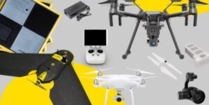
What is the Best Drone for Mapping
What is the best drone for mapping or surveying an area? That is a pretty loaded question as you end up going down quite a rabbit hole. It really depends on what you are trying to achieve and for what purpose. There is no use flying a $200k aerial LiDAR system over a residential construction site to monitor progress. First of all the budget wouldn’t support it and you probably wouldn’t get the data you needed from a laser scan anyway. In this
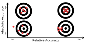
LiDAR v Photogrammetry
These two forms of site surveying using drones are incredibly powerful deliverables to construction site managers and land owners although they have different pros and cons.
Simply put, aerial based LiDAR involves attaching a laser scanner to the base of an drone and flying over an area. The unit revolved in a circular motion with lasers shooting out points toward the ground. Each time a point hits an object it is recorded. This has the ability to weasel it’s way through tree canopies and vegetation until it reaches the ground in what we call 2nd returns. The result is a point cloud rendering a 3D image of it’s environment. This is perfect for areas with vegetation in which a detailed and accurate elevation model is required. It’s also great for areas with narrow or intricate objects such as powerlines or railings. The downside is that it is very expensive due to the cost of LiDAR scanners and also the point cloud deliverable doesn’t provide a reality view of the environment.
Photogrammetry uses images which are geo-referenced and processed to create a 2D orthomosaic or 3D model of an environment. It can deliver a very realistic view of the environment although more ideal for bare earth environments as we aren’t able to get an accurate record of the contours and lay of the land. When using a PPK or RTK enabled drone, centimetre level accuracy is possible which provides incredible amounts of value for various use cases. In this article, we will focus on the best drones to use for drone surveying using photogrammetry techniques.
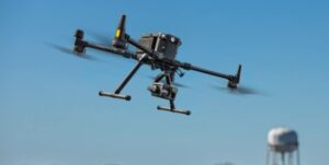
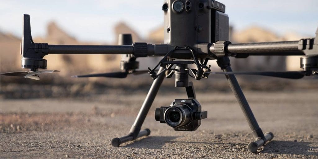
DJI M300 and P1 sensor
As far as integrated solutions go, this has to be the top of the pile. DJI’s release of the M300 in 2020 was nothing short of incredible with it’s H20t sensor. Then the P1 mapping sensor became available. Lets talk about the sensor and gimbal first. A 3-axis gimbal supports a full frame 45mp global mechanical shutter sensor. Shutter speed can capture images at 1/2000 of a second for tack sharpness. The ability to take an image every 0.7 as well as the 45mp count means it can cover a large area by flying higher and faster than any other multi drone out there.
TimeSync 2.0 aligns the camera position and in combination with the RTK module provides incredible accuracy. The camera also has the ability to change lenses between a 24/35/50mm option. This has many use cases. In the case of mapping you could fly above obstacles such as high trees and towers while still being able to have a very high level of image resolution.
The M300 also has a number of smart automated features such as 3D oblique capture, Detailed Mission Modelling and Real-Time Mapping Mission. In most cases it will capture a site in half the time it takes a Phantom 4-RTK. As far as aerial mapping goes, if you have a lot of work to get through that requires a high quality and accurate data set, the M300 with P1 is the one.
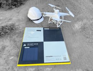
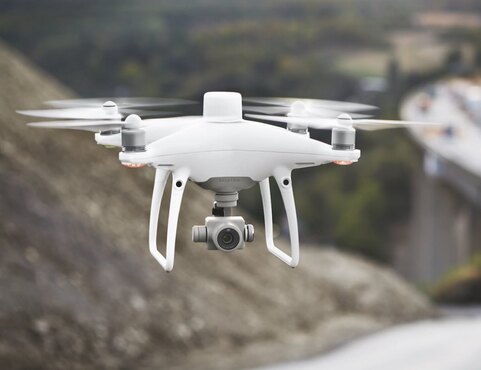
DJI Phantom 4-RTK
This is an updated version of the ever popular Phantom 4 Pro V.2. The only difference is the RTK module clearly to look like the Quasimodo model of the Phantom 4 series. It’s a 20mp sensor with an integrated RTK module and has TimeSync. It also records data in PPK. The P4-RTK has been used by High Exposure to survey many sites in Sydney and the surrounding areas and produced amazing results very with ease of use. This high end survey drone still has relevancy and in a lot of cases is still preferred over the M300 with P1. This is why.
The Cost – You don’t get much change out of approx $28,000AUD with the M300 and P1. The P4-RTK will set you back about $8,000.
Size of the Area to be Mapped – Yes it is slower than the M300/P1 although it still takes less than 15min to fly a nadir mission on a site that is 5Ha. Sure the 20mp camera sensor won’t provide as much detail, although if you are flying relatively smaller areas or have more time you can always fly lower to achieve more resolution.
The Compact size – The drone itself is a lot easier to lug around due to its small size. It’s also faster to set up and get up in the air. Carrying around a big cumbersome case gets old very quick, especially if it isn’t necessary.
The accuracy is very good – It’s possible to get 2cm absolute accuracy if using the right techniques and processing method. You won’t hear of many site managers requiring better accuracy than this.
DJI Phantom 4 Pro V.2
An even cheaper option than the above is the old plain jane Phantom 4 Pro V.2. Although it does not have RTK or PPK capability, it is still possible to obtain a high level of accuracy with the correct ground control and processing techniques. It takes more time to lay the ground control so an even slower option the RTK version although it comes in at under a third of the price point. If you are mainly capturing orthos and models of construction sites for progress updates and speed or accuracy isn’t of utmost importance, then this is your guy.
Sensefly Ebee X RTK
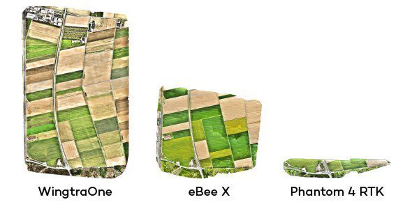
This is a fixed wing drone specifically designed for mapping large areas. Benefits over a multi rotor drone include being able to fly longer and further and therefore covering much more area. One battery lasts 90min and can cover 70Ha at 57m altitude (1.2cm/px). The Aeria payload packs a 24mp sensor. It does have RTK/PPK capabilities. It’s more expensive than a Phantom 4 RTK being around the $20,000 AUD price point with camera included. A negative of fixed wing drones are they can become damaged over time due to the potential for rough landings. They also need a lot of room for launch and landing and would not be useful in smaller construction sites or similar areas.
Wingtra One PPK
If very large area drone surveys are all you’re interested in then the Wingtra One is the best choice. It is a VTOL drone which stands for vertical take off and landing. Therefore it can launch and land straight up and down like a multi rotor drone and then take advantage of it’s fixed wing capabilities during flight. This allows it be flown in almost any environment and over large distances. The Sony RX1RII sensor has 45mp which is able to create incredible detail and accuracy when used with it’s PPK feature. In one battery, the Wingtra One can cover 110ha at 93m achieving a GSD of 1.2cm/px. This is 1.5x the Ebee X. Drone and payload can cost around $40,000AUD and is the most expensive option although if you have enough work to put it through its paces it will do it in no time at all.
When comparing the other mapping drones, the Wingtra One PPK is recommended for very large areas, DJI M300 P1 for medium sized areas and if you plan to use it for other functions such as 3D modelling and Inspection work. The P4-RTK is our winner for value and will produce great results for construction sites.
Please reach out to High Exposure for any enquiries in regards to aerial mapping in Sydney or New South Wales