How Drones are used in the Mining Sector
The use of drones in mining leads to increased efficiency, reduced costs, enhanced safety, and better overall management of mining operations. The technology continues to evolve, offering even more advanced capabilities to further benefit the mining industry
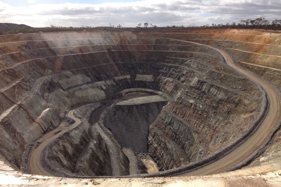
ABOUT Mine site surveys
Data Driven Insights
Utilising various sensors, a drone is able to collect enormous amounts of accurate data of natural areas quickly and accurately. Laser scanning and photogrammetry, are capable of understanding the mine site environment with incredible accuracy and resolution
Service Group
Mine Site Applications
Aerial Surveys and Mapping
Drones equipped with high-resolution cameras and LiDAR sensors are used for aerial surveys and mapping. They can quickly and accurately capture detailed images and data, creating 3D models, topographical maps, and digital elevation models
Stockpile Monitoring
Drones can efficiently monitor and measure the volume of stockpiles of minerals, rocks, or other materials. This helps in accurate inventory management and ensures that the quantity of materials on-site aligns with production and sales expectations.
Infrastructure Inspection
Drones can inspect mining infrastructure, such as equipment and high walls, with greater efficiency. Early detection of potential issues allows for proactive maintenance, reducing downtime and extending the lifespan of equipment
Remote Monitoring of Inaccessible Areas
Drones can access remote and challenging terrains that may be difficult or dangerous for humans to reach. This capability is particularly useful for monitoring and surveying in areas with difficult access.
Safety Inspections
Drones are used for safety inspections of mining sites, including high walls, equipment, and infrastructure. They can quickly identify potential hazards, ensuring compliance with safety regulations without exposing personnel to unnecessary risks
Regulatory Compliance
Drones help mining companies comply with regulatory requirements by providing accurate and up-to-date data for reporting and documentation purposes. This ensures adherence to environmental, safety, and operational regulations
Environmental Monitoring
Drones can monitor environmental aspects of mining operations, helping companies comply with regulations and reduce their environmental impact
Regulatory Compliance
Drones aid in reclamation planning by assessing the progress of rehabilitation efforts on mined areas. They provide valuable data for evaluating the success of reforestation, erosion control, and other restoration initiatives
Service Group
Benefits over traditional methods
Accessibility to Inaccessible Areas
Drones can access difficult or dangerous terrain, such as dense forests, steep slopes, or areas with limited human accessibility. This makes it possible to collect data from locations that would be challenging for ground-based surveys
Repeatable and Consistent Surveys
Drones can fly predefined routes with high precision, ensuring consistency in data collection during repeated surveys. This is important for tracking changes over time
Reduced Environmental Impact
Compared to traditional survey methods, drones have a smaller environmental footprint, as they do not require heavy machinery or ground vehicles to cover large areas
Real-time Data Collection
Drones can provide real-time data, enabling rapid response to environmental changes or emergencies. Real-time monitoring can be crucial for tracking dynamic environmental conditions, such as wildfires, flooding, or pollution events
Customisation and Flexibility
Drones can be equipped with a variety of sensors, allowing for customization based on the specific needs of the environmental survey. This flexibility makes them adaptable to different types of studies
High-resolution Imaging
Drones equipped with high-resolution cameras and scanners that can capture detailed imagery of the environment. This is particularly useful for monitoring changes in land cover, vegetation health, and identifying specific features or anomalies
Cost-Effective Monitoring
Drones are often more cost-effective than traditional survey methods, such as manned aircraft or ground-based surveys, especially for large or remote areas. They can cover large expanses of land in a relatively short amount of time, reducing overall survey costs.
Safety
There is no need to put a human in a dangerous position which eliminates any potential threat to injury