In the world of drone mapping, accuracy is everything. Whether it’s in relative terms or absolute. The level of precision required depends on a multitude of factors, ranging from intended applications to budget constraints. Let’s take a look into the nuances of survey accuracy and examine scenarios where relative accuracy suffices over absolute accuracy.
Understanding Precision Levels
Before delving into the intricacies, it’s essential to grasp the concept of survey-grade accuracy. When a project mandates survey-grade precision, the data’s accuracy must withstand legal scrutiny. This level of precision, verified by licensed surveyors, is indispensable for endeavors like land development and floodplain surveying, where legal disputes hinge on accurate measurements.
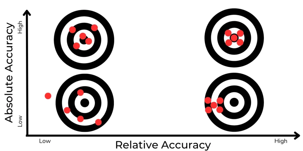
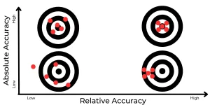
What is Relative Accuracy?
Relative accuracy, also known as local accuracy, gauges the precision of points within a map concerning each other. In simpler terms, if a distance between two points measures 20 inches in reality, it mirrors the same on the map. This level of precision suffices for tasks like visual inspections, progress monitoring, and crop surveillance.
For instance, imagine overseeing the construction of your dream home. The architect provides a 3D model where the distance from the roof to the ground is depicted as 30 feet. Post-construction, measuring the same distance reveals an accurate alignment with the model.
Relative accuracy proves invaluable in scenarios where spatial referencing isn’t crucial. Tasks like damage assessment, 3D modeling for promotional purposes, and volume measurements within a defined area thrive on relative accuracy. This is just using the onboard GPS a modern DJI drone without using RTK, PPK or GCP’s.
Achieving Relative Precision
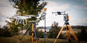
To attain reliable relative accuracy, attention to detail is paramount. Calibration of drone cameras, coupled with GPS synchronisation, minimises errors and ensures consistent measurements. Incorporating Real-Time Kinematic (RTK) modules further enhances GPS accuracy, albeit contingent on robust cellular connectivity.
Relative Accuracy Expectations
The horizontal relative accuracy typically corresponds to twice the Ground Sample Distance (GSD). For instance, if your GSD measures 1 cm per pixel, the horizontal accuracy will approximate to 2 cm. Conversely, the vertical relative accuracy typically amounts to three times the GSD.
What is Absolute Accuracy?
Absolute accuracy, also dubbed global accuracy, transcends local referencing, aiming to precisely correlate map points with real-world GPS coordinates. This level of precision is indispensable for professional surveys, land development, and environmental assessments.
Consider the scenario where you need to demarcate your property line for erecting a fence. Accessing historical land surveys ensures absolute accuracy in delineating property boundaries, crucial for legal compliance and dispute resolution.
Absolute precision is indispensable when integrating datasets from disparate time frames or overlaying geo-referenced site plans. Construction projects, environmental surveys, and land development initiatives demand unerring latitude and longitude coordinates to withstand future scrutiny.
Factors Influencing Accuracy
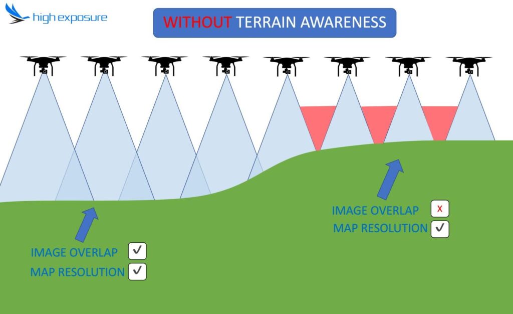
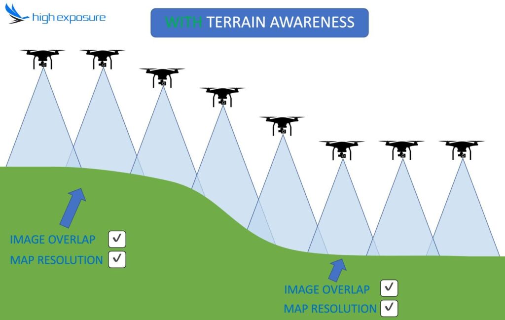
Aside from using RTK & PPK enabled drones, there are several factors that need to be taken into consideration to achieve an accurate map or model.
Image Overlap
A minimum overlap of 70 percent is imperative, ensuring that each point in the scene is captured from multiple perspectives. This redundancy is pivotal for accurate reconstruction, as it minimises occlusions and enhances feature matching. Notably, the higher the overlap percentage, the greater the fidelity and precision achieved. 80% forward and side overlap is preferred in drone surveying if there is time and resources available. Some areas may need even more overlap than this depending on what is being captured.
To ensure adequate image alignment and coverage, the drone’s takeoff point plays a pivotal role. Departing from elevated positions facilitates broader coverage, minimising the risk of insufficient overlap. Conversely, low takeoff points may result in suboptimal overlap, particularly when the drone inadvertently flies too close to the ground. Strategic takeoff points thus contribute to optimal image alignment and fidelity. Ideally a terrain awareness feature which is available in most high end modern drones is preferable. This enables the drone to gain and lose altitude depending on the terrain to maintain a consistent overlap (and GSD).
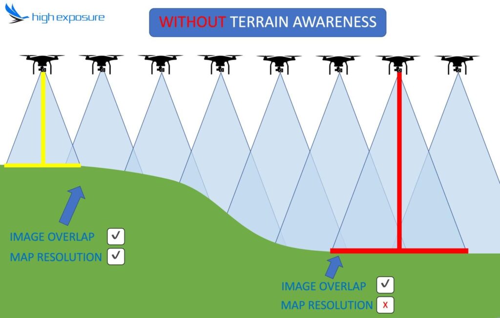
Understanding Ground Sample Distance (GSD)
Central to image resolution is the concept of ground sample distance (GSD), which delineates the real-world size of each pixel in captured drone imagery. GSD typically ranges between one and ten centimeters, with higher values indicating lower resolution and vice versa. Crucially, finer resolution translates to enhanced accuracy and detail in reconstructed models.
Factors Influencing GSD
GSD is contingent on several factors that influence imaging fidelity:
-
Camera Sensor Resolution: The megapixel count of the camera sensor inversely impacts GSD, with lower resolutions yielding higher GSD and vice versa.
-
Flight Altitude: Altitude significantly affects GSD, as higher altitudes result in larger ground coverage per pixel, thereby reducing resolution and accuracy.
-
Camera Field of View: The wider FOV (in other terms, the shorter the focal length of the camera lens), the higher the GSD, owing to the increased coverage area per pixel.

Flight Parameters for Precision
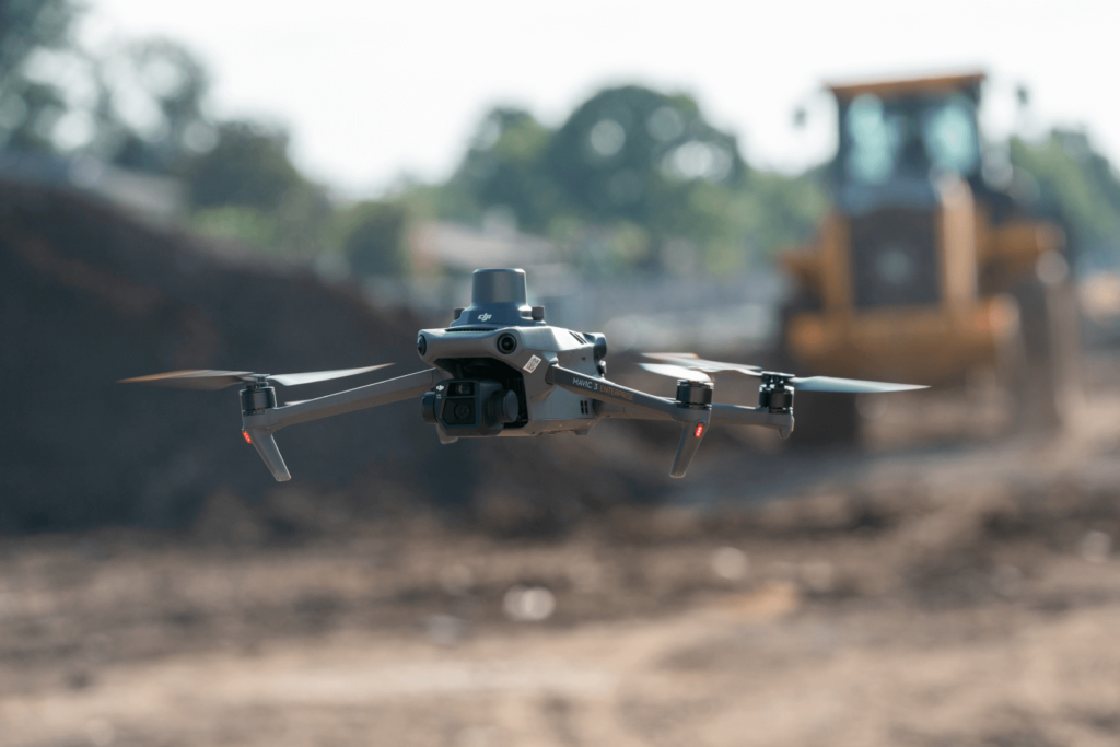
Flight speed plays a pivotal role in determining imaging accuracy. Slower drone velocities coupled with higher shutter speeds result in sharper images, facilitating more precise feature extraction and matching. Consequently, careful adjustment of flight parameters is imperative to optimise imaging fidelity and accuracy. It is crucial to use a drone camera with a global sensor for high accuracy maps.
Striving for Consistent Accuracy
Ground control points (GCPs) serve as anchors in the real world, augmenting global accuracy by aligning map coordinates with GPS coordinates. While GCPs enhance precision, their necessity varies depending on the project’s scope and requirements.
Choosing the Right Accuracy Level
Before each project, High Exposure will discuss the requirements and objectives with the client to determine what relative/absolute accuracy is necessary. This can save time and cost as well as ensuring the deliverables are able to satisfy the end purpose effectively.