The Use of Drone Surveys in Sydney and their Benefits

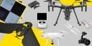
Drone Survey Potential
There is a lot of potential for drone survey technology in Sydney, thanks to the city’s varied landscape and wealth of construction and development projects. UAVs can be used to capture detailed aerial images of a site, which can then be used to help with planning, design, assessment and monitoring.

Construction Sites
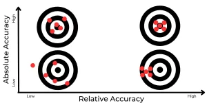
The use of drone survey technology has already been proven successful in Sydney and the benefits are quickly being realised even amongst experienced surveyors themselves. For example, drone surveys were are being used on a daily basis across dozens of sites in Sydney every single day. The high grade of accuracy achieved on a 3D model continues to impress project managers and even surveyors who are not familiar with the technology.The use of drone surveys on construction sites can help with the following
– Progress monitoring
– Surveying and mapping inaccessible areas
– Health and safety planning
– Stockpile volume calculations
Environmental Drone Surveys
Environmental drone surveys are also becoming more popular in Sydney, thanks to the city’s many environmentally sensitive areas. UAVs can be used to capture images and videos of an area to help with environmental impact assessment (EIA), land management and even ecological research.
The benefits of drone survey technology for environmental purposes have already been seen in Sydney. For example, drone surveys have been used to help with the assessment of a major new road development that was planned to go through an important wetland area. The drone survey data was able to identify aspects of the wetland that may have been impacted by the new road and allowed for modifications to be made to the original plan.
It is clear that drone survey technology has a lot of potential in Sydney and the benefits are being realised by businesses and organisations across the city. With the ever-growing popularity of drone surveys, it is likely that this technology will play an even bigger role in Sydney’s future.
Accident Reconstruction Survey
Drones are increasingly being used for accident reconstruction surveys. The drone’s ability to quickly and easily capture still images and video can be a huge help in determining the cause of an accident
The use of drone technology for accident reconstruction surveys is already becoming popular in Sydney due to the heavily urban environment and the likelihood of vehicles causing accidents. An accurate drone survey can provide measurements, show skid marks and give a life like reality to the scene. This can be completed in under 20min after arriving to the scene allowing the accident to be cleared up and avoid further delays to traffic.

Photogrammetry Surveys
A popular type of drone survey technology in Sydney is photogrammetry surveys. This involves the use of drone-mounted cameras to capture high-resolution images of an area which can then be used to create a 2D map or 3D model.
The benefits of using drone-mounted cameras for photogrammetry surveys are becoming increasingly clear in Sydney. For example, the City of Sydney Council has used drone-mounted cameras for photogrammetry surveys to create a detailed 3D models of particular structures and areas of the city. These models can be used for a variety of purposes, such as creating an interactive map of the city and helping with urban planning.
It is clear that drone survey technology has a lot of potential in Sydney and businesses and organisations are already realising the benefits. With the ever-growing popularity of drone surveys, it is likely that this technology will play an even bigger role in Sydney’s future.
Road and Rail InfrastructureSurvey
As Sydney’s population continues to grow, the need for better road and rail infrastructure becomes increasingly important. This is where drone survey technology can be a huge help
Drones can be used to quickly and easily capture images of an area which can then be used to create a 2D map or 3D model. This data can then be used to help with the planning and construction of new roads and rail infrastructure.
The NSW Government has already started using drone survey technology for road and rail infrastructure surveys. For example, drone survey data was used to help plan a new major road development that was going to go through an important wetland area. The drone survey data was able to complete flights throughout construction to ensure things were on track and to pick up and errors that might cause costly delays.

Shark Monitoring
Lately, drone survey technology has also been used for shark monitoring. This is done by using drone-mounted cameras to capture images of sharks in their natural environment.
The benefits of using drone-mounted cameras for shark monitoring are becoming increasingly clear in Sydney. For example, NSW Surf Life Saving has been using drones to survey Sydney’s popular beaches to monitor and report the sightings of sharks in order to keep swimmers and beach goers safe.
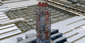
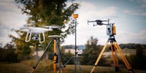
LiDAR Surveys
LiDAR surveys are a type of drone survey that use lasers to measure distances between objects. This allows for the creation of detailed 3D models of an area which can be used for a variety of purposes.
Sydney based businesses have been using LiDAR surveys to create detailed 3D models of various assets such as man made structures like dam walls, telecommunication towers and buildings as well as areas of land. The main benefits to using LiDAR is the ability to remove vegetation from the deliverable in post processing as well as being able to pick up every little detail such as powerlines, thin railings and leaves.

It is clear that drone survey technology has a lot of potential in Sydney and businesses are already realising the benefits. With the ever-growing popularity of drone surveys, it is likely that this technology will play an even bigger role in Sydney’s future.
If you’re interested in drone survey technology, then please get in touch with us at info@highexposure.com.au