Aerial Facade Inspection of Genesis Tower
Brief:
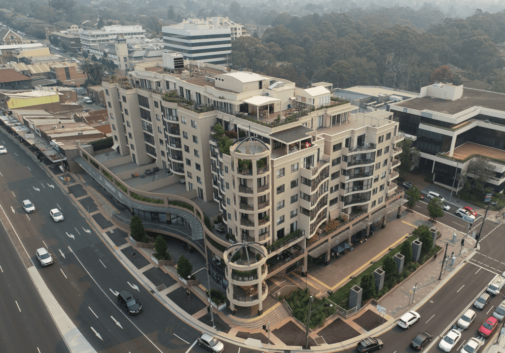
Genesis tower is one of the largest developments in amongst the bustling Epping town centre consisting of 2 levels of underground carparking, retail and commercial areas on the ground floor as well as 6 levels of apartments.
There was evident cracking in the facades of the structure and the decision was made by the building management team to arrange an inspection to determine the extent of the cracking.
For an inspection team using rope access, to make the process cost effective they would need to repair all the cracks as they go rather than complete in 2 separate events. This could result in a huge amount of expenditure that is not within budget. There needed to be a solution in which there was potential to only repair defects that needed urgent attention.
Solution:
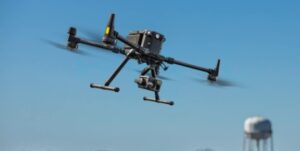
Using high resolution cameras attached to GPS stabilised remotely piloted drones, High Exposure were able to inspect the entire structure in a day and provide a full image report showing each and every crack on the building facades. This proved to be safer, faster, cheaper and resulting in higher quality data than what might have otherwise been possible using traditional methods.
Deliverable Option 1 – 2D Map
The inspection images were uploaded to infrastructure reporting software. A high resolution 2D map using photogrammetry was created in which the images were overlayed on top. Each geo-tagged image is represented as a point on the map where they were taken from. You can then click on any point in the map to display the image and then create annotated defects within the software which can also be exported. This creates an affordable and contextual view of the asset making it easy to determine and create reports on the list of defects.
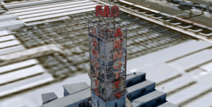
Deliverable Option 2 – 3D Model
A 3D model of the building was also created later as a demonstration for the client to showcase its powerful ability to deliver complete asset knowledge of the structure.
A methodical photogrammetry capture process using drones was used in conjunction with a powerful processing and reporting software to visualise the building in a life like 3D space. It is essentially the creation of a ‘digital twin’ of the building. The user can navigate around the structure and zoom in to see incredible detail. It Provides a highly contextual and intuitive product enabling users to quickly and easily make informed decisions. It is also possible to record defects and create annotations as well as take accurate measurements. This is the ultimate in asset inspection technology.
Outcome
The highly contextual and visual deliverable did not have any gaps or areas that could not be inspected and allowed assessors to make well informed decisions based on the high quality data from the comfort of the office. Previously the assessors would be making decisions from hand written notes and mobile phone images that lacked quality and context and proved to be subjective in nature. The data allowed the building managers to determine which cracks were of urgent attention and to ensure these were fixed immediately. The other cracks of much lower severity will be monitored in following inspections.
Contact High Exposure if you are looking to improve the way you conduct asset inspections.