Drone LiDAR & Photogrammetry Survey – Gregadoo Waste Management Centre

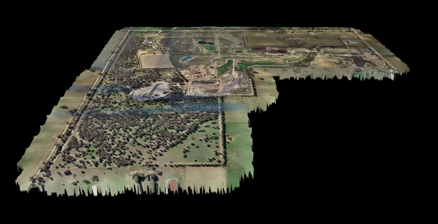
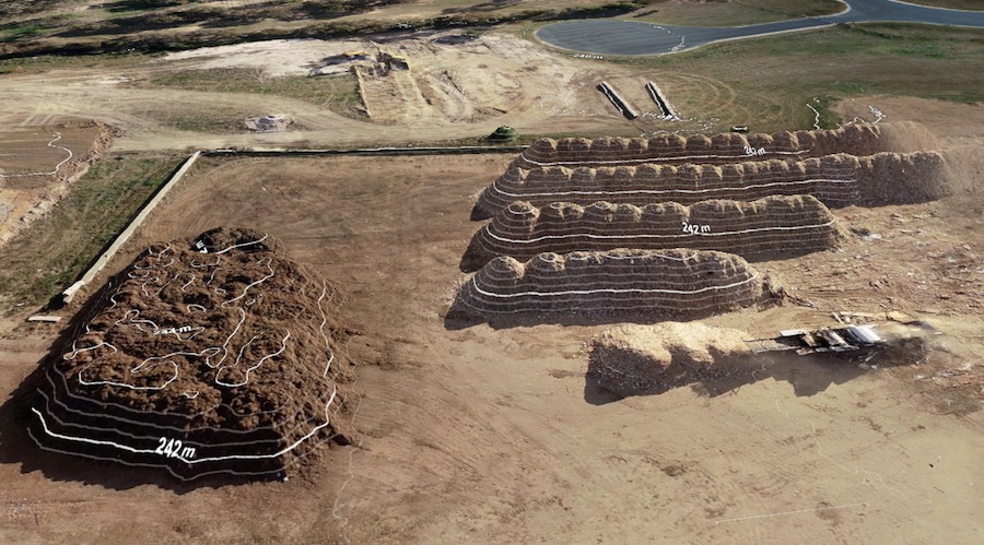
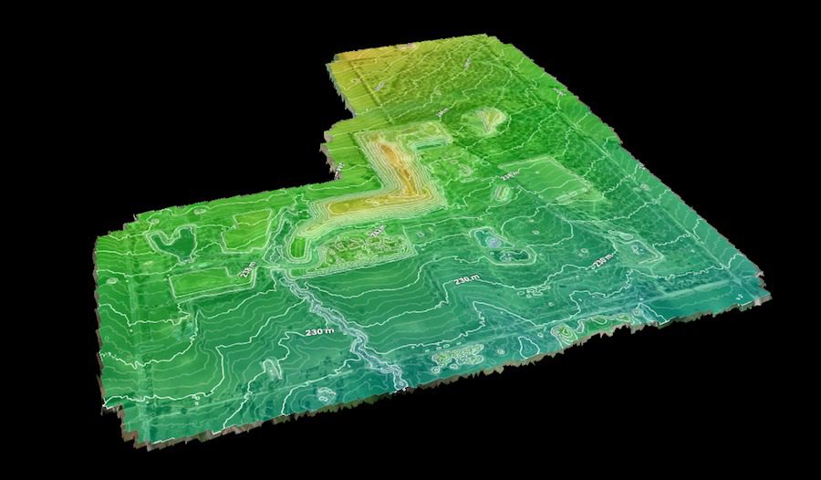
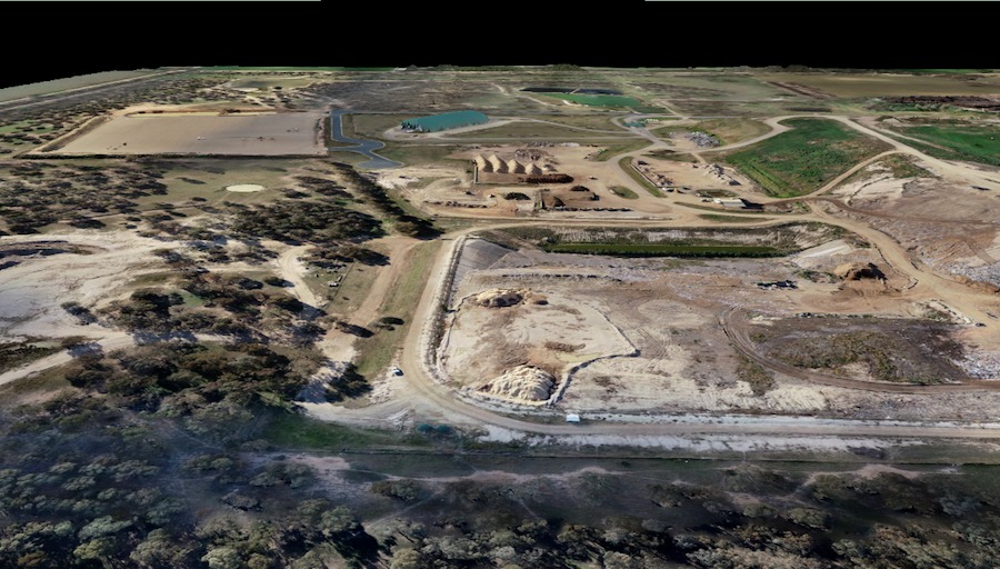
High Exposure Commercial Drone Services undertook an aerial survey at the 250-hectare Gregadoo Waste Management Facility, employing drone photogrammetry and LiDAR capture techniques. The primary objective was to provide the Riverina Council with an accurate elevation model, facilitating the design of new waste management cells and providing a digital record of site vegetation and ongoing activities.
Objective:
    • Provide the Riverina Council with a high-precision elevation model to aid in the design of new waste management cells.
    • Document and preserve the site’s current condition through accurate digital terrain and surface models.
    • Achieve a high level of accuracy with a tolerance of 50mm.
    • Utilise ground control points (GCPs) for precise geo-referencing and accuracy validation.
  •  
Photogrammetry DSM of Gregadoo Waste Management Facility
Methodology:

Ground Control Point Placement:

      • Ground control points were meticulously positioned across the entire 250-hectare site a day prior to the survey.
      • Each point was accurately marked, with one point being established on a known reference point for calibration purposes.

LiDAR Data Capture:

        • A drone equipped with a LiDAR sensor was deployed to scan the entire site.
        • The drone maintained optimal altitude and overlap to ensure comprehensive data coverage.
        • LiDAR scanning captured dense data points of the bare earth for generating a high-quality digital terrain model (DTM).

Photogrammetry Imagery Capture:

      • Following the LiDAR scan, an RTK (Real-Time Kinematic) drone was launched to capture photogrammetry imagery.
      • Imagery was captured at a ground sample distance of 3cm, ensuring high-resolution coverage.
      • The imagery acquisition process was planned to cover the entire site comprehensively with a high level of image overlap.
Data Processing: 
    • LiDAR data was processed, cleaned, and delivered in .e57 format, providing accurate and detailed information on the site’s topography.
    • Photogrammetry imagery was processed to generate a Digital Surface Model (DSM)
    • Orthophoto colorisation was applied to LiDAR data to enhance visualisation.
    • GDA 2020 AHD (Australian Height Datum) was utilised for geospatial referencing and data processing.
Data Delivery & Visualisation: 
    • Final deliverables included LiDAR data files in .e57 format and colorised ortho photo imagery.
    • The DSM derived from photogrammetry was uploaded to an online 3D model viewer, enabling the client to navigate the site and obtain accurate measurements and volumes.
Outcome: 
  • High Exposure Commercial Drone Services met the accuracy requirements specified by the Riverina Council.
  • The provided elevation models facilitated the design and planning of upgrades to the waste management facility.
  • The digital records of vegetation and site conditions serve as valuable references for future assessments and developments.
  • The combination of LiDAR and photogrammetry techniques resulted in comprehensive data coverage and precise topographical information.
Conclusion: 

High Exposure Commercial Drone Services’ aerial survey at the Gregadoo Waste Management Facility exemplifies the efficacy of utilising advanced drone technology for environmental monitoring and management. By employing LiDAR and photogrammetry techniques, the project successfully delivered accurate elevation models meeting the client’s requirements, thereby facilitating informed decision-making and planning for site upgrades and developments.