Why Use Drones to Inspect Power Lines
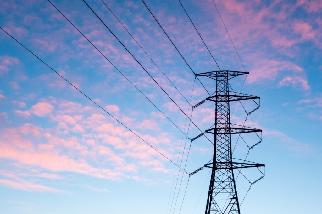
Power line inspections are a costly, time-consuming process. A visual inspection of power lines are usually required every 1–2 years and a more detailed inspection once in every 3–5 years. With the sheer volume of this infrastructure across Australia, drones are the ideal tool to complete these routine inspections. Many of the areas are remote and can be difficult to access. High Exposure can deploy a team of experienced operators to ensure optimal data is acquired, stored, managed and sufficiently delivered to the client. Overhead transmission lines can transmit high levels of interference which is why our drones are equipped with systems to combat this and ensure optimal imagery is captured regardless of the environment.
Using LiDAR to Monitor Encroaching Vegetation
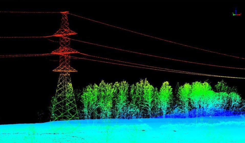
Using drone LiDAR (Light Detection and Ranging) for monitoring power lines and encroaching vegetation is an effective strategy to reduce the risk of bush fires. LiDAR technology mounted on drones can provide high-resolution and three-dimensional data about the terrain and vegetation surrounding power lines. Here’s how this approach can be beneficial:
Early Detection of Vegetation Encroachment:
- LiDAR allows for precise and detailed mapping of the vegetation canopy near power lines. It can detect even small branches or foliage that may pose a risk.
Accurate 3D Mapping:
- LiDAR produces accurate three-dimensional maps of the terrain, providing a comprehensive view of the power line corridor. This detailed mapping helps in assessing the height, density, and proximity of vegetation.
Easy Data Analysis & Reporting:
- LiDAR data can be processed using specialized software to automate the analysis of vegetation proximity to power lines. This allows for efficient identification of potential hazards to generate actionable reports for the vegetation maintenance staff.
Risk Assessment:
- By combining LiDAR data with GIS (Geographic Information System) software, utilities and land management authorities can conduct risk assessments to identify areas with a high risk of vegetation-related incidents.
Customised Vegetation Management Plans:
- The collected data enables the development of customized vegetation management plans. Utilities can prioritize and schedule vegetation clearing based on the specific risks identified through LiDAR analysis.
Enhanced Safety:
- Regular LiDAR monitoring provides a proactive approach to vegetation management, reducing the risk of power outages and wildfires caused by vegetation encroachment.
Improved Efficiency:
- Drone LiDAR surveys are faster and more efficient than traditional methods, such as ground-based surveys or manual inspections. Drones can cover large areas quickly and access challenging terrain.
Reduced Operational Costs:
- The use of drones for LiDAR surveys reduces operational costs associated with traditional methods, such as helicopter-based surveys or manual inspections, making it a cost-effective solution.
Compliance with Regulations:
- Many regions have regulations in place that require utilities to monitor and manage vegetation near power lines to reduce fire risks. Using drone LiDAR helps in complying with these regulations efficiently.
Data Integration with Utility Systems:
- LiDAR data can be integrated into utility management systems, allowing for seamless communication and coordination between field operations and decision-makers.
Emergency Response Planning:
- LiDAR data can assist in emergency response planning by identifying high-risk areas and allowing for the development of contingency plans in the event of extreme weather conditions or other emergencies.
Other Use Cases
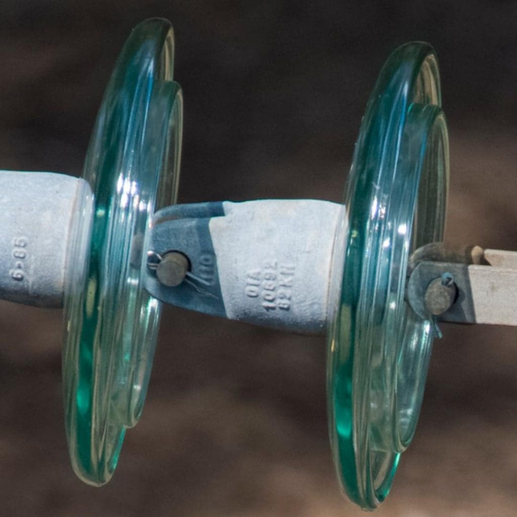
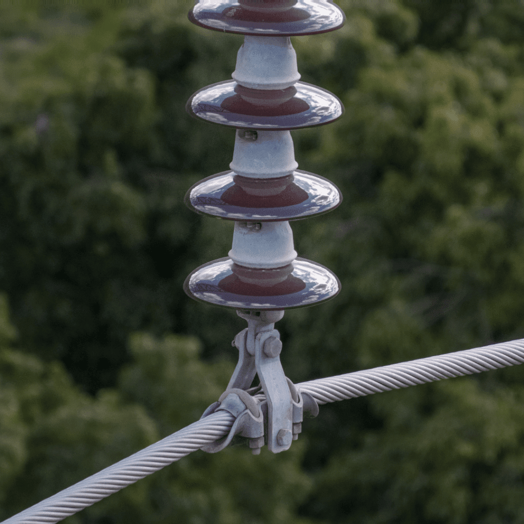
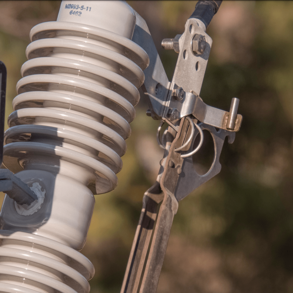
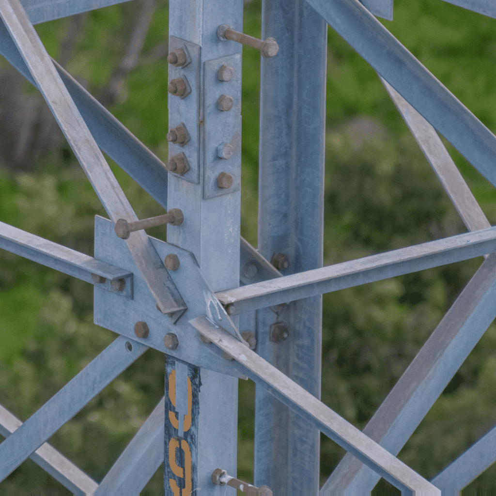
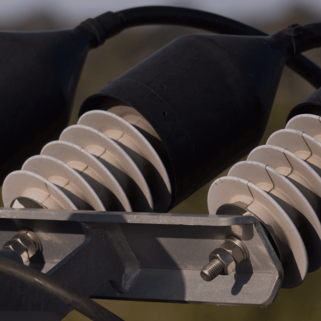
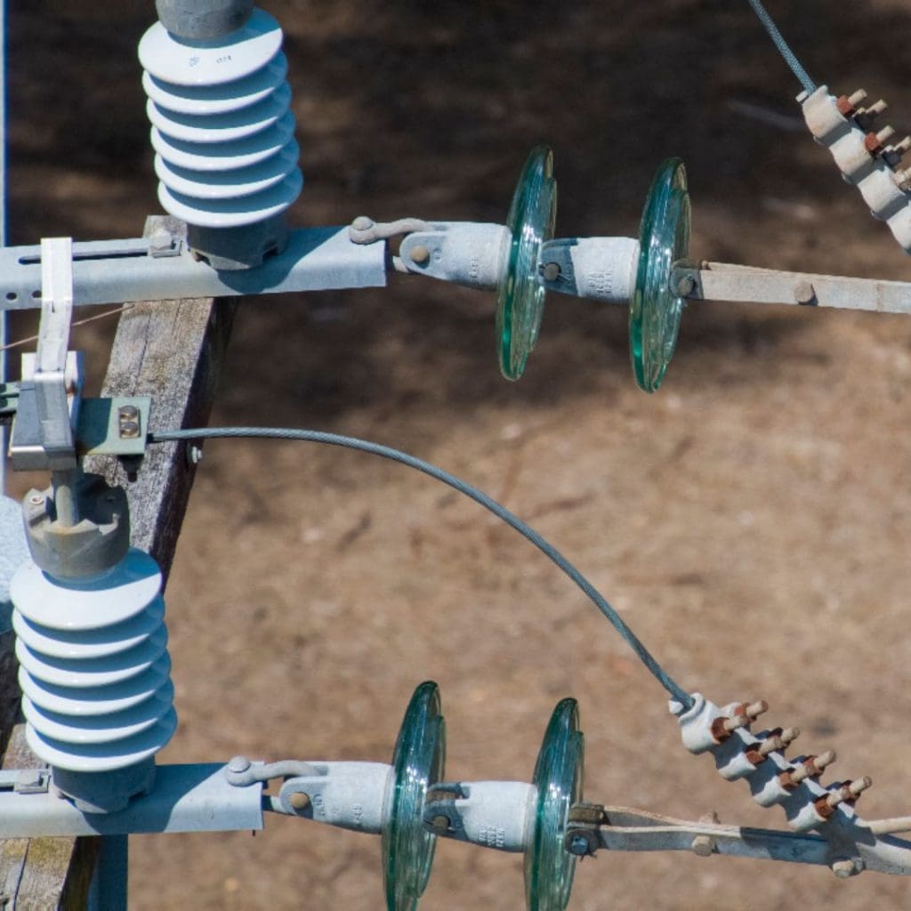
- Routine inspections to identify corrosion, missing bolts, birds nesting, or other abnormalities
- Recording of inventory
Data Management
This is a very important aspect of our deliverable. It’s crucial that context is given to each image to allow assessors to understand exactly where the issues are located on the power line or transmission tower as well as the location of the tower itself. Geo-referenced imagery is placed on a satellite map to show exactly where the image was taken which saves time and ensures decisions are made quickly to allocate resources to undertake maintenance.
Image Gallery