Aerial Mapping and Surveying for your Construction Site
The use of photogrammetry to create survey accurate representations of your site is an invaluable tool for all site managers. This data can be utilised for asset classification, construction validation as well as health and safety. In particular, a frequent mapping schedule provides a time series of the progress on a work site to identify new issues and mitigating risk rather than responding to it.
There are many bottle necks that can be encountered on construction sites, unforeseen issues and variables that aren’t easy to deal with. Using drone technology for aerial mapping on your construction site can keep these issues under control.
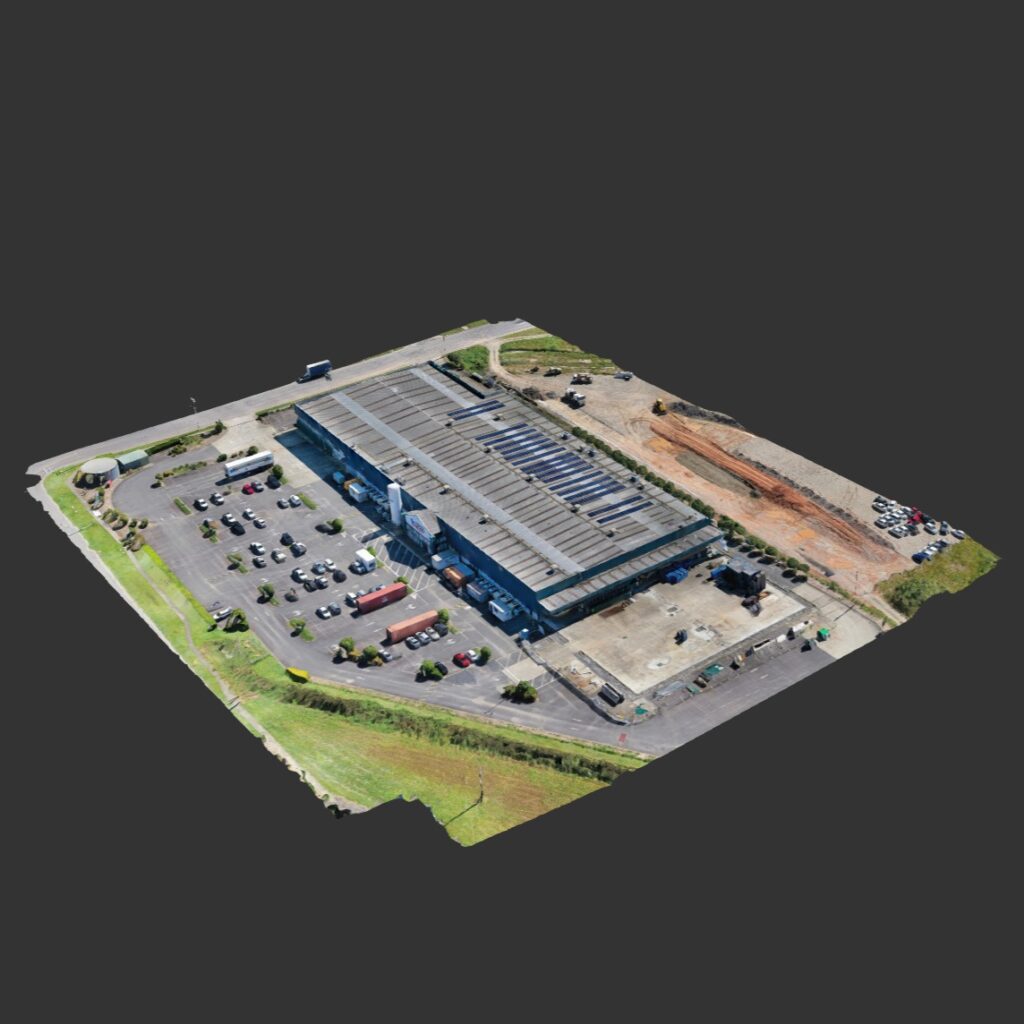
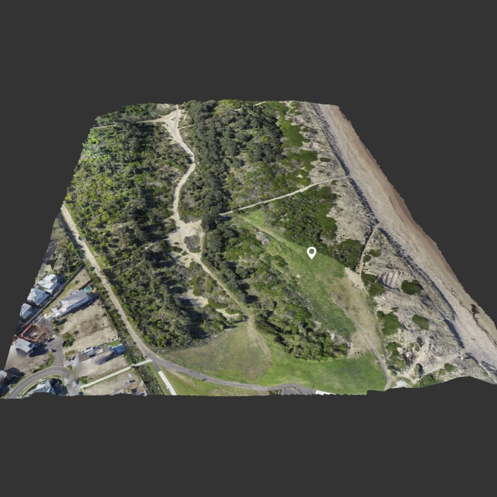
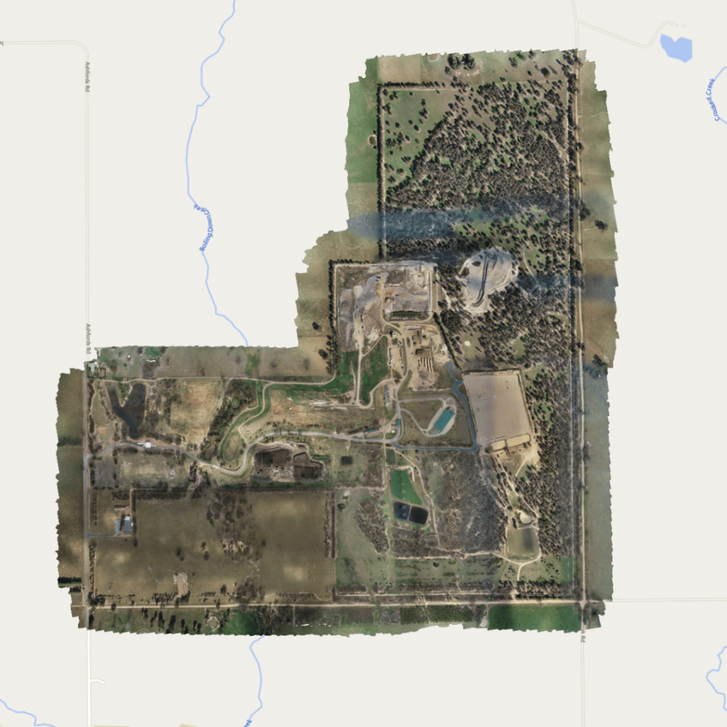
Mapping drones can be used to monitor the current status and change in a construction site during operations. This is essential to determine the alignment between project planning and actual construction. These aerial maps can be shared online between stakeholders in the project to ensure everyone is on the same page and issues can easily be understood and rectified quickly.
Observing a visual change in the works
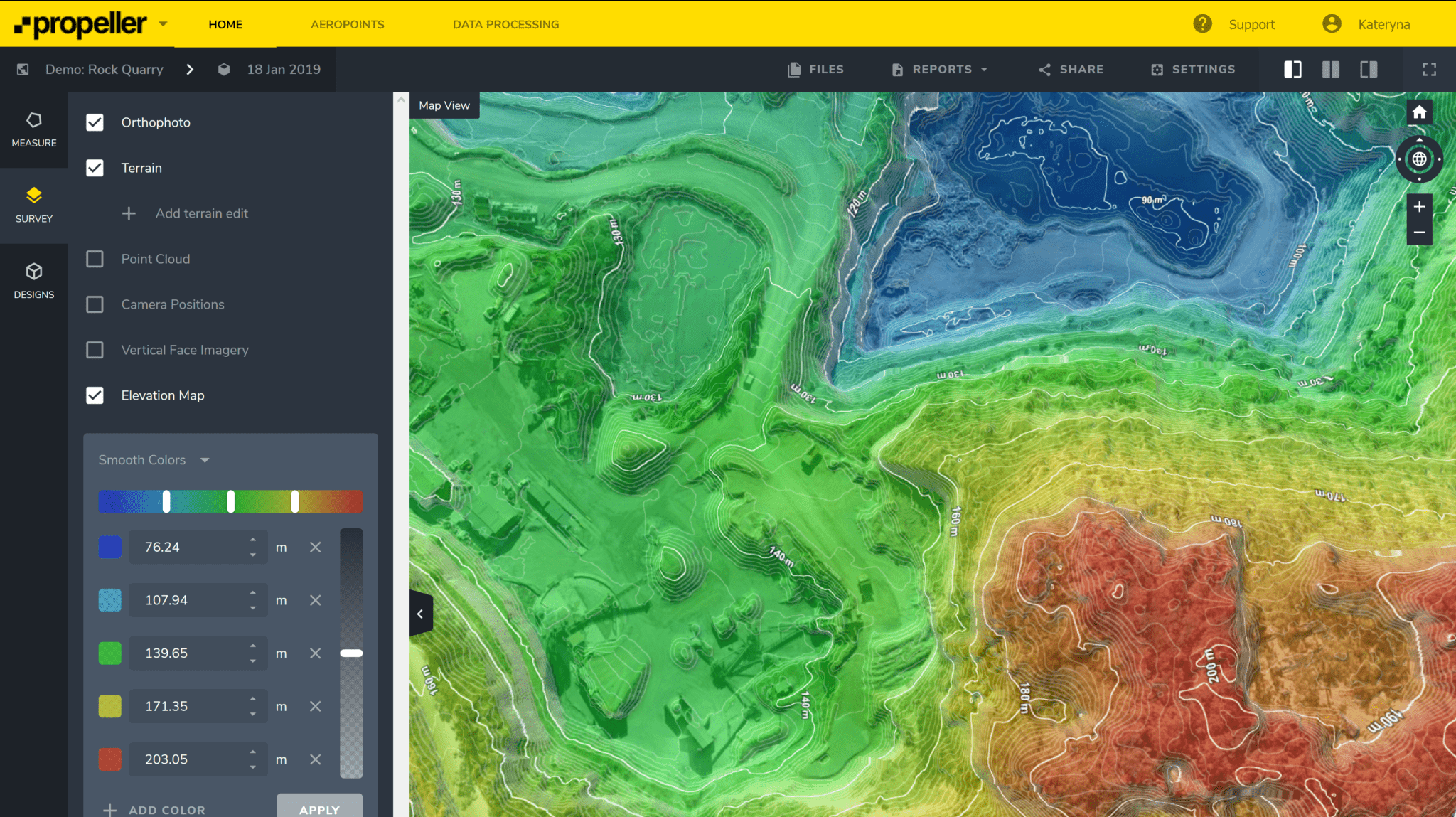
Cross sectional analysis for earth works or road grading for example
Cut and fill feature for accurately estimating earthwork volumes
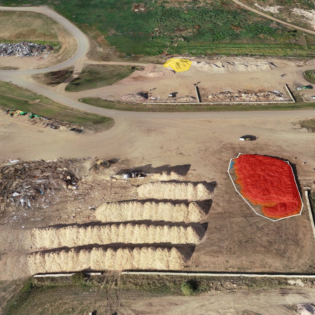
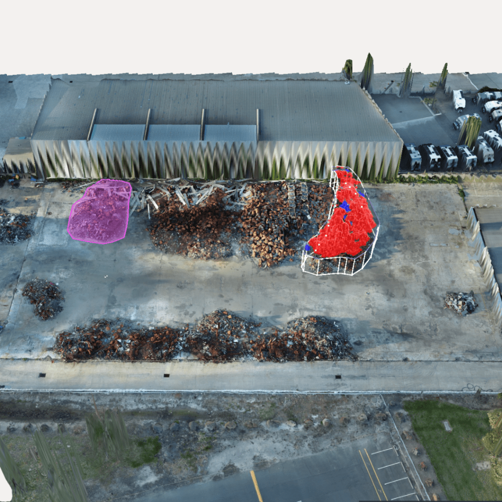
Volume Calculations to determine the depletion of a material on site
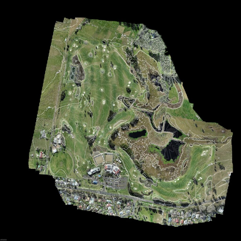
Elevation/contour maps can be utilised in a number of ways although especially useful for flood modelling