Photogrammetry & Laser Scanning
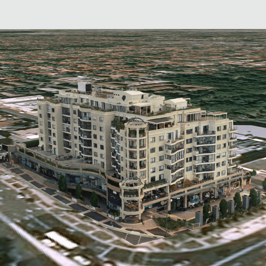
Creating high quality realistic life like models of construction sites, properties, buildings or other infrastructure provides a context to an otherwise complex and difficult structure or area. A photogrammetry capture process that has been developed and refined is used to ensure a high quality digital twin . These images are then processed to generate an interactive model that you are able to view on your computer or device. Being able to navigate a structure from your office that you would ordinarily need rope access, scaffolding or elevated work platforms to access.
3D models created by drones in combination with other terrestrial sensors offer a suite of benefits that traditional surveying isn’t able to match. Having the capability to navigate around a digital twin of your asset leaves no gaps in the knowledge and a digital record that can be shared with other stakeholders.
These 3D models provide the accuracy and precision to measure point to point distances, areas and volumes. Creating these annotations and producing PDF reports that can easily be shared with contractors and other parties.
The use of photogrammetry in surveying and GIS projects has become more widespread with the rise of drone technology. It is now possible to capture high-quality 3D models that are accurate to within 20-30mm
The ability to assess a structure from a computer enables asset owners to quickly and easily make informed decisions.
High Resolution Digital Twins
Years of expertise and experience enable the capability to generate highly detailed and accurate life like 3D models of your asset.
The added benefit of being able to host these models in an online viewer allows unique benefits to easily analyse and understand your asset without any gaps in knowledge.
These include measurement and annotation capabilities as well as being able to click on a point in the model and view the jpeg image, providing the best of both worlds.
Use Cases
The possibilities for digital twins have grown in the last few years and have been a proven method for analysing assets efficiently, safely and at reduced cost
- Building Information Modelling (BIM)
-
3D As built Models in AutoCAD, Revit, Autodesk BIM360
-
2D CAD drawings
-
Elevation & Gradient analysis
-
Defect mapping
-
Topographical plans
-
Vegetation Overhead clearances
-
Plant 3D models
-
creating digital historical records
-
monitoring change
Infrastructure
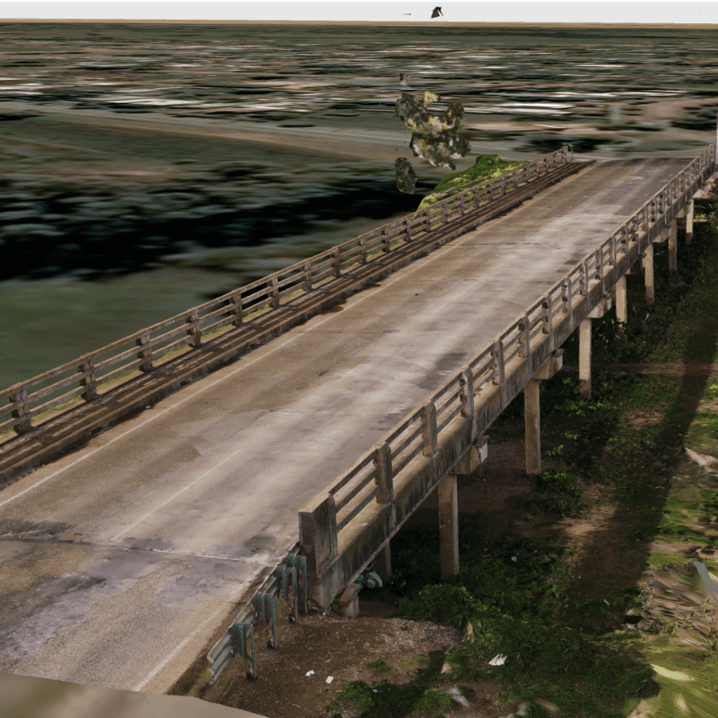
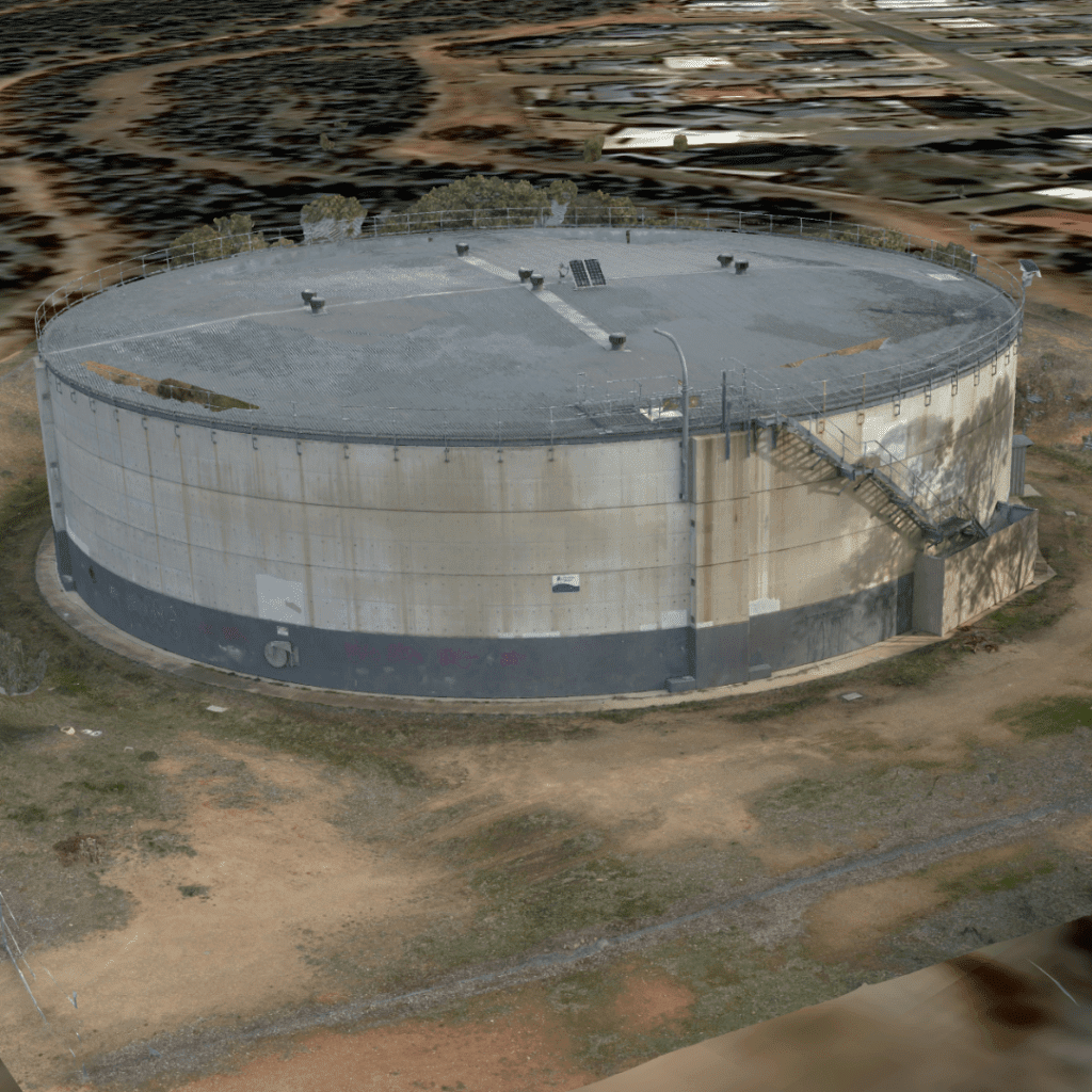
High Resolution 3D models are now possible of intricate and complexed infrastructure which can be used for BIM models, inspection defect mapping, change detection monitoring and digital record keeping
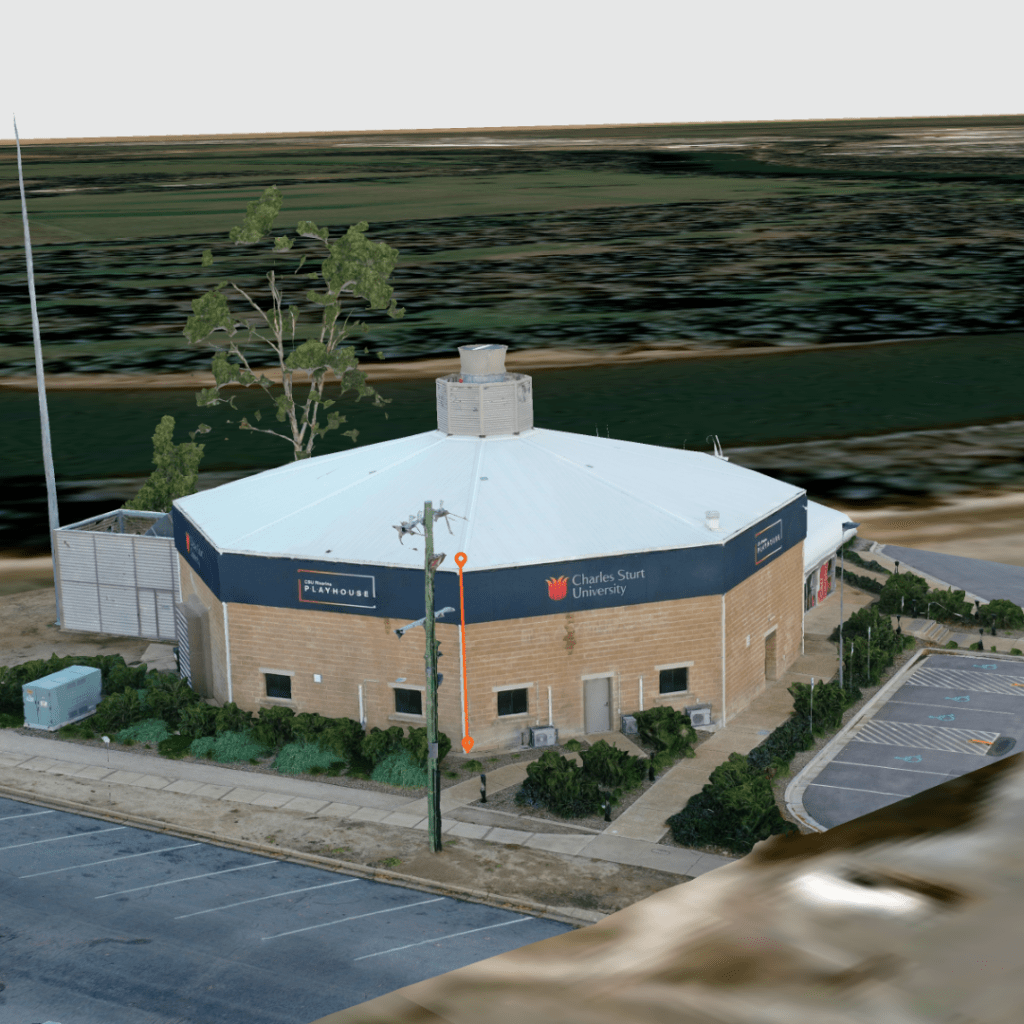
- Buildings
- Residential Houses
- Schools
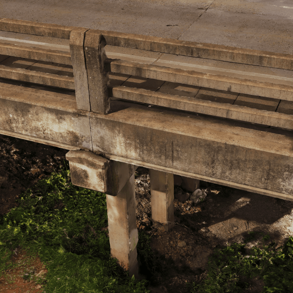
- Bridges
- Dams
- Chimney Stacks
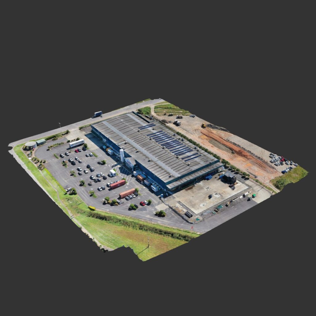
- Warehouses
- Pipe Lines
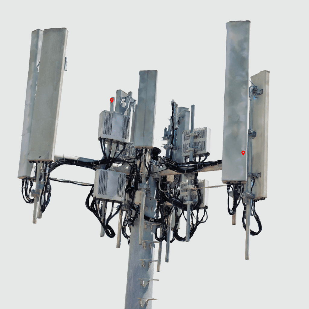
- Telecommunication Towers
- Heritage Structures
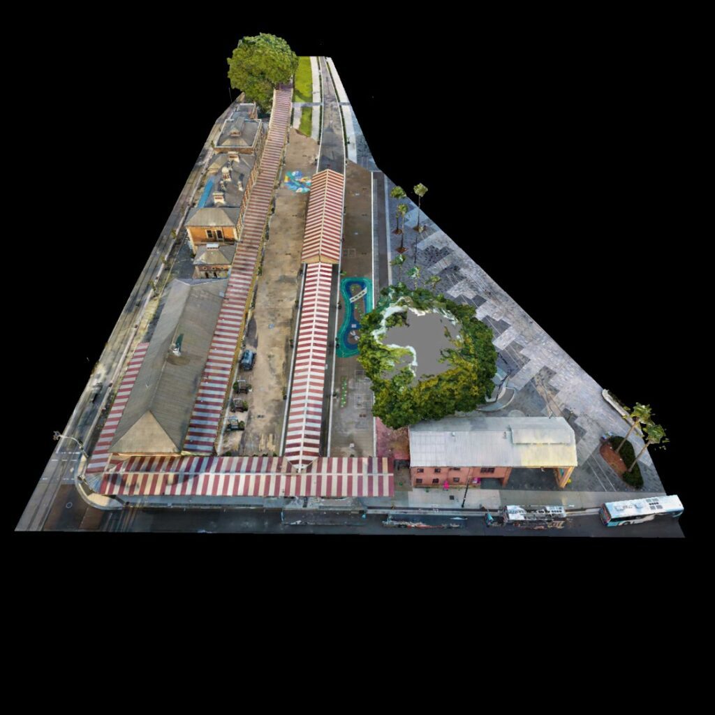
Sites
Depending on the requirements a digital twin or pointcloud can be generated to provide an acuurate representation of the area. LiDAR has the capability to penetrate vegetation to view the topography of the bare earth.
- Golf Courses
- Open Pit Mines
- Sand Dunes
- Roads & Rail Corridors
- Power Stations
- Military Bases
- Solar Farms
- Construction Sites
- River Banks
- Forests & Bushland
The New Solution to an Old Problem
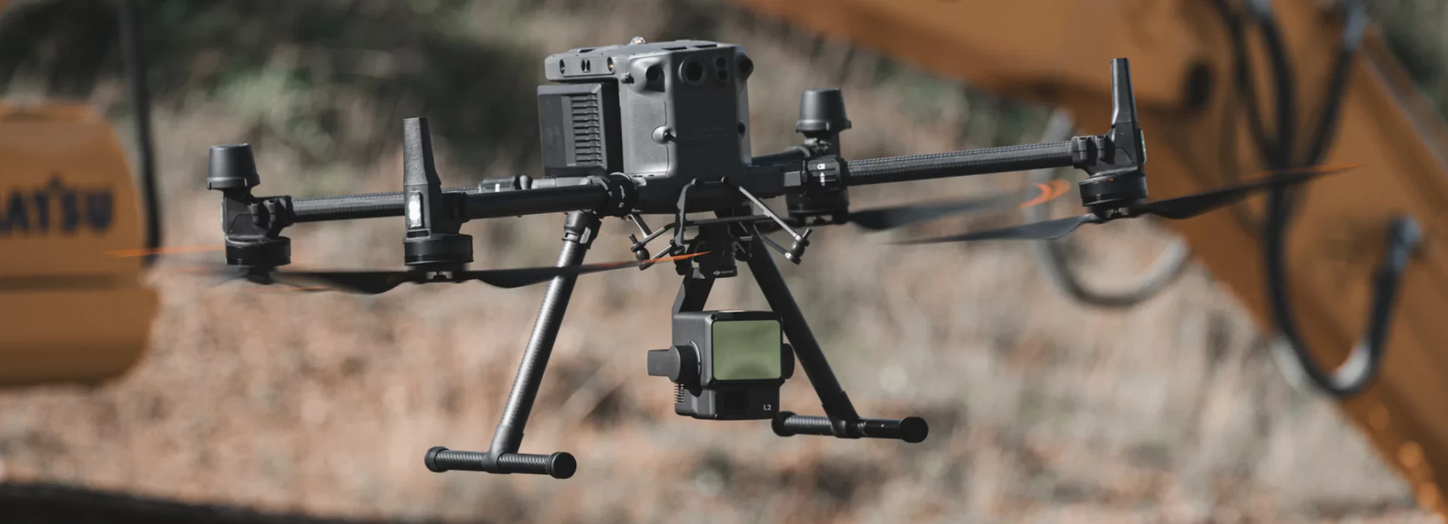
Construction sites are turning to drones for a number of reasons, with construction drone maps & models becoming the newest way that these locations can be surveyed. Drone mapping (also called aerial surveying) is accomplished through taking pictures from between 20-120m using software which then creates an accurate 3D map showing everything at your work area in great detail.
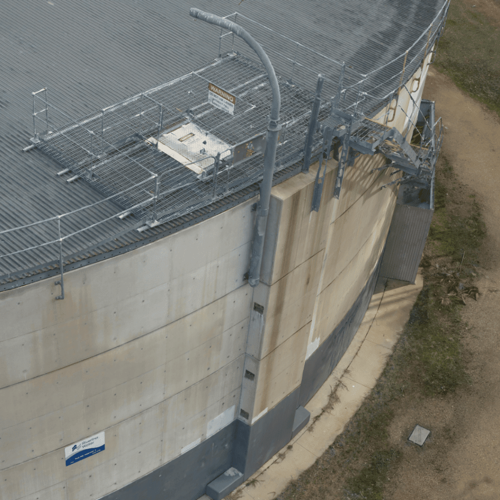
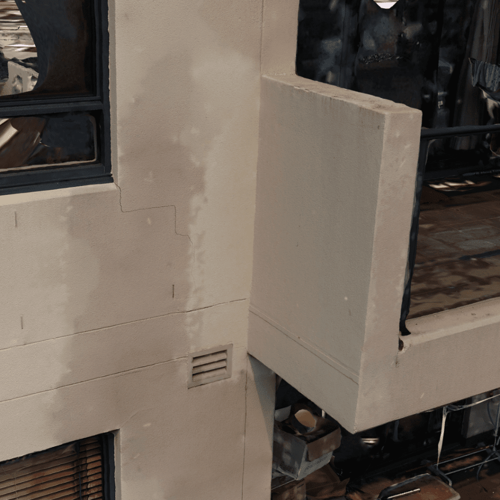
In some cases for very high resolution models the drone may be less than 5m from the structure capturing sub millimetre resolution and picking up fine cracks and issues.
This technology could improve site efficiency by allowing professionals access areas previously un-reachable without authorisation; identify potential dangers before they occur resulting in saving lives on work sites.
Drone 3D models can help you assess the condition of an asset in an environment that is much easier to identify faults and defects as opposed to looking through a folder of potentially hundreds or thousands of images. Once you have found an issue with the site or structure you will know it’s exact location. These issues can be marked on the model and provided to engineers, contractors and stakeholders.
Artificial Intelligence software integrated into the 3D model hosting platforms allows automatic identification of issues within the 3D model. AI Algorithms are trained to identify faults in a range of different structures and materials. While it is still recommended an engineer go over the model this is a huge time saver in allowing resources to be allocated to other tasks.
In some cases using a laser scanner is more beneficial to a project to be able to penetrate and remove vegetation the deliverable. This method also allows more precision for thinner objects such as railings, poles or antennas. Contact us to determine what is the best method for visualising your project.
Image Gallery