About Us
Collecting data and imagery of the physical environment to provide our clients with meaningful information
- Home
- About Us
New Solutions to Old Problems
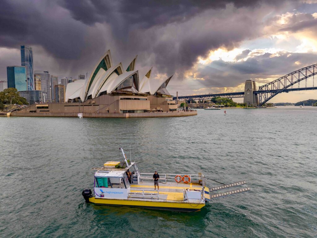
Commercial Drone Data Services in Sydney
High Exposure was founded in 2016 and is a CASA certified provider of remotely piloted aircraft inspection, drone survey and mapping services .
With a passion for innovation and a commitment to excellence, High Exposure was formed with the aim to combine the power of advanced aerial technologies with a keen understanding of industry needs. We specialise in providing highly contextual, data rich solutions for a diverse range of sectors, including infrastructure, telecommunications, energy, agriculture, environmental monitoring, and construction.
We believe in using technology to disrupt conventional outdated methods for data capture and visualisation by demonstrating improvements in;
Cost-Effectiveness:
Drones offer a cost-effective alternative to traditional methods of data collection. They can cover large areas quickly and efficiently, reducing the need for extensive manpower and resources.
Accessibility:
Drones provide access to hard-to-reach or hazardous areas, such as disaster-stricken zones, construction sites, or remote agricultural fields. This accessibility enables data capture in environments that might be challenging or unsafe for humans.
Speed and Efficiency:
Drones can rapidly collect data over large geographic areas, enabling faster decision-making processes. This is particularly valuable in delivering data for large projects with a short turn around in time sensitive scenarios.
Precision and Accuracy:
With advancements in technology, drones can capture highly accurate data by using advanced drone survey equipment such as RTK, PPK capabilities, high megapixel camera sensors and laser range finders. This precision is crucial in fields such as inspection, construction, telecommunication, survey and environmental.
Real-Time Data:
Drones can transmit data in real-time, allowing for immediate analysis and decision-making. This is especially valuable in applications like monitoring construction events, tracking environmental changes, or responding to emergencies.
Versatility:
Drones can be equipped with various sensors, cameras, and other data capture devices, making them versatile tools for a wide range of applications. They can be customised to meet the specific needs of different industries.
The Drone Data Capture Experts
Industry Experts:
Harnessing the capabilities of state-of-the-art drones and other aerial platforms, we deliver unparalleled precision in data collection and analysis. Our skilled team of professionals is adept at conducting detailed inspections and surveys, providing our clients with comprehensive and actionable insights. From capturing high-resolution imagery to generating 3D models and mapping terrain, we utilise the latest advancements to ensure accuracy and efficiency in every project we undertake.
Solutions Tailored to Meet Project Requirements:
Understanding that every project is unique, we pride ourselves on our ability to plan a strategy to utilise our services to meet the specific requirements of our clients. Whether you need detailed asset inspections, land surveying/scanning, or highly detailed digital twin creation, we have the expertise and technology to exceed your expectations.
Safety First, Always:
Safety is at the core of everything we do. Our operations adhere to the highest industry standards, and we prioritise the well-being of both our team and the environments we work in. With a focus on compliance and responsible drone use, we ensure that our services not only meet but exceed regulatory requirements.
Equipment to Get the Job Done
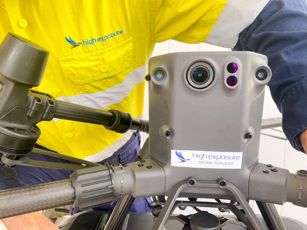
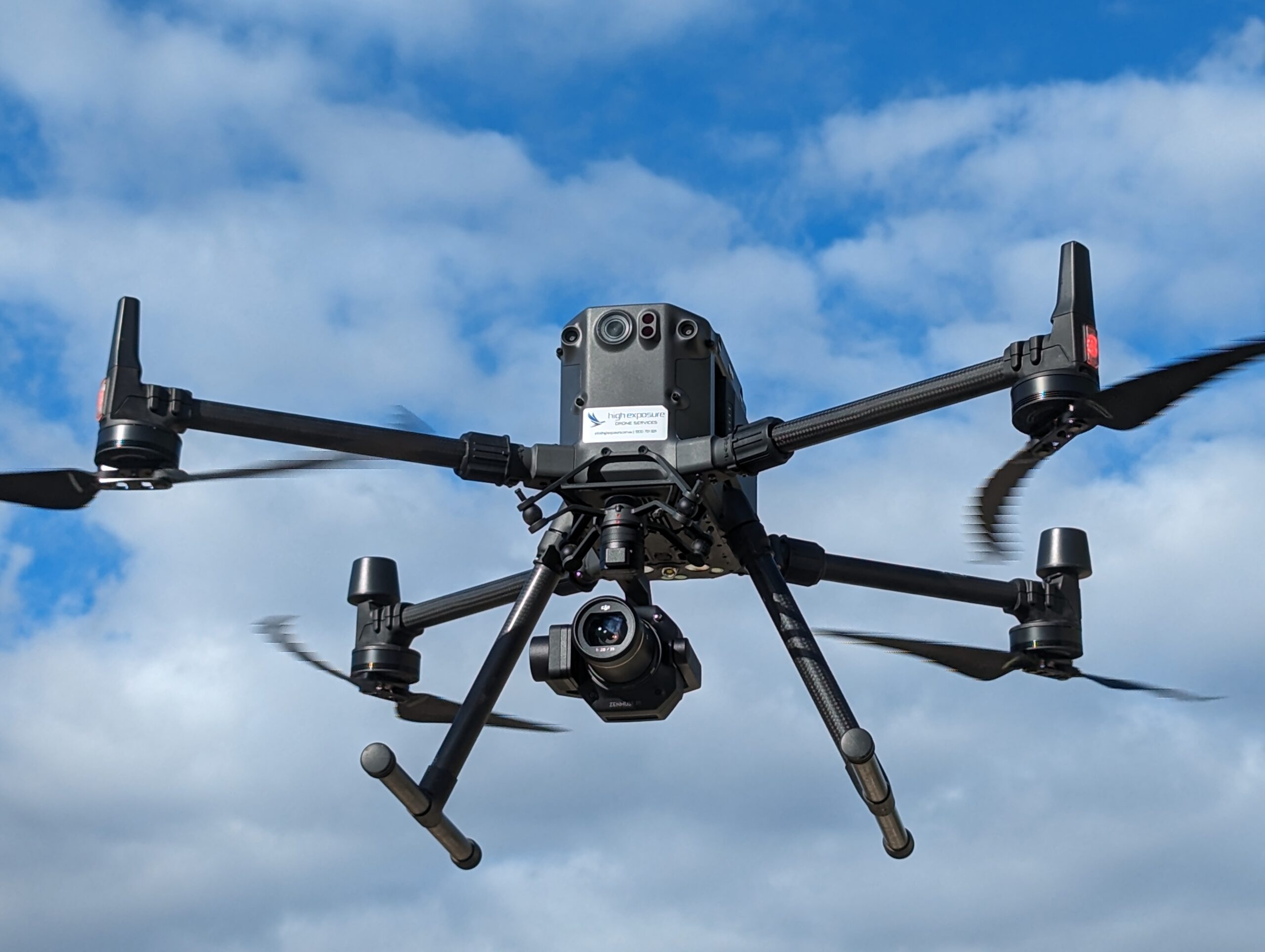
Drone Selection
Utilising a variety of RPA's (remotely piloted aircraft) depending on the task at hand. Payload capacity is an important choice to ensure it can carry the correct sensor for the job. There are other considerations such as weather, GPS accuracy, automation capabilites, weather resistance, range, flight time as well as integration with 3rd party sensors and applications.
Payload
The project goals need to be clearly defined. Whether you are looking for a leak in a roof or trying to create a pointcloud of a building there are a variety of sensors to consider. LiDAR, photogrammetry, zoom lenses, high megapixel RGB, thermal to name a few.
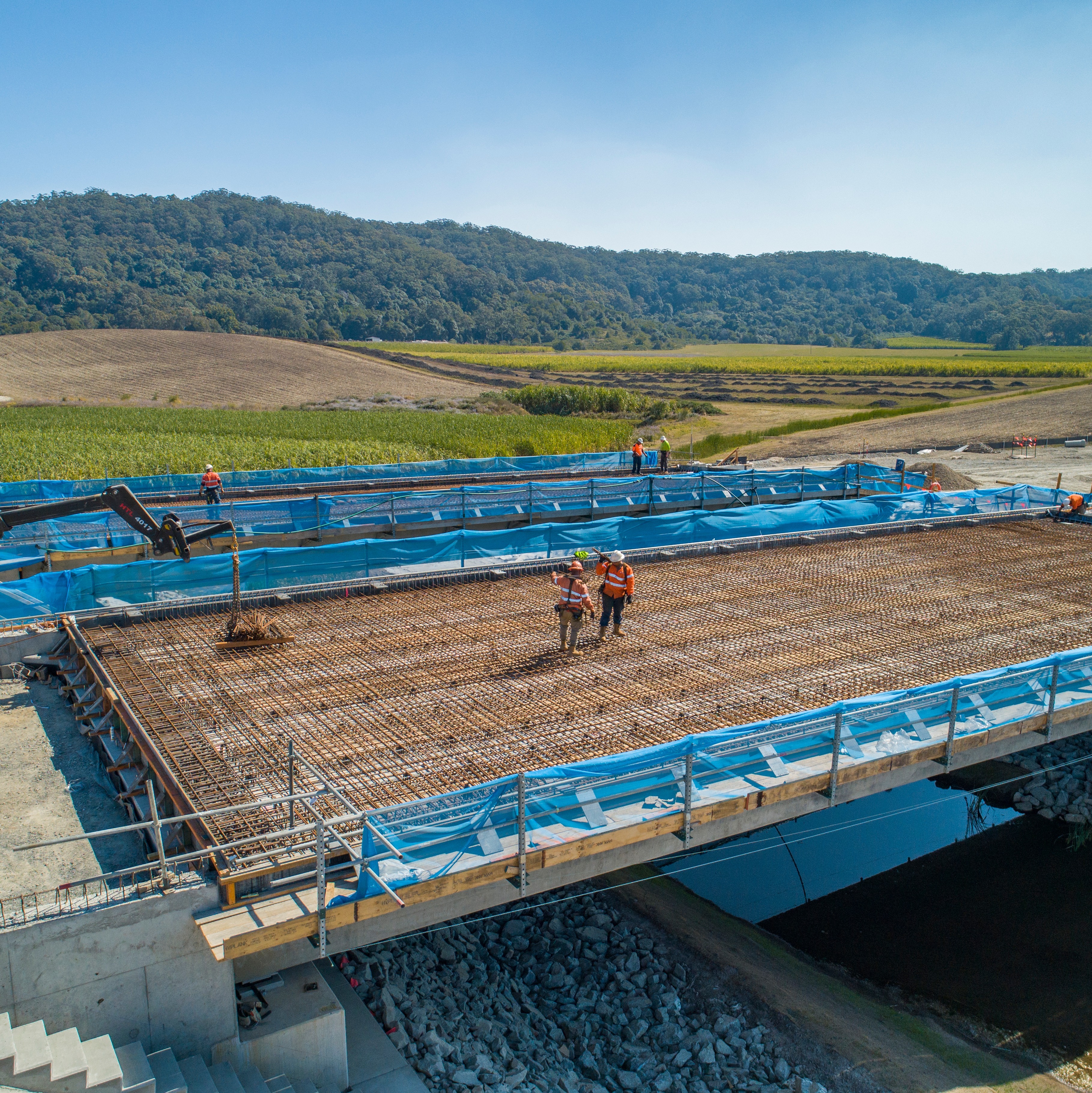
Processing
Effective processing of data in survey and inspection projects is crucial for transforming raw information into meaningful insights. Effective data processing enhances the accuracy, reliability, and usability of survey data, allowing for informed decision-making and valuable conclusions.
The Right People for the Job
Having the right people involved in drone projects is crucial for their success. The success of a drone project depends not only on the technology and equipment used but also on the expertise, skills, and collaboration of the individuals involved.
What we do
Expertise
Lorem ipsum dolor sit amet, consectetur adipiscing elit. Ut elit tellus, luctus nec ullamcorper mattis, pulvinar dapibus leo.

Our Leadership
Leadership and Governance
Egestas feugiat suspendisse iaculis litora auctor vitae habitant gravida ac nec vulputate. Consectetur proin blandit sed at vehicula duis integer nostra consequat pede. Ipsum mus sapien convallis taciti enim volutpat.